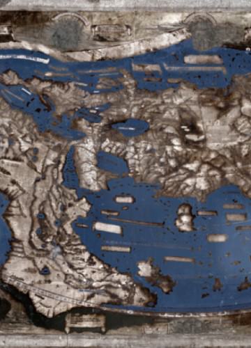
Henricus Martellus, a German cartographer working in Florence in the late 15th century, produced a highly detailed map of the known world. According to experts, there is strong evidence that Christopher Columbus studied this map and that it influenced his thinking before his fateful voyage.
Martellus’ map arrived at Yale in 1962, the gift of an anonymous donor. Scholars at the time hailed the map’s importance and argued that it could provide a missing link to the cartographic record at the dawn of the Age of Discovery. However, five centuries of fading and scuffing had rendered much of the map’s text and other details illegible or invisible, limiting its research value.
A team of researchers and imaging specialists is recovering the lost information through a multispectral-imaging project. Their work is yielding discoveries about how the world was viewed over 500 years ago. Read more in this YaleNews article.