Last fall, when the COVID-19 pandemic moved her introductory biology laboratory to Zoom, Maria Moreno, senior lecturer and research scientist in Molecular, Cellular and Developmental Biology, saw an opportunity to try something new.
Working with GIS Librarian Miriam Olivares and Life Sciences Librarian Lori Bronars, Moreno developed Yale’s first Geospatial Learning Accelerator for undergraduates, a six-week course module that gives students an intensive introduction to Geographic Information Systems (GIS) technology.
GIS provides a structure for assembling, analyzing, and visualizing any kind of data together with spatial location data. The technology is particularly effective for revealing social, economic, and health disparities.
The new instructional module was one of five within Moreno’s course, Laboratory for Foundations of Biology, and the first of its kind for Yale undergraduates.
Moreno’s 64 students were organized into 15 teams, each charged with researching a topic and presenting their findings using StoryMap, a GIS tool licensed by Yale Library that translates complex concepts into visual stories with text, interactive maps, images, and other multimedia content.
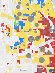
The students’ final StoryMap projects, published in the Esri Teach with GIS hub, vividly explore a wide range of pressing health issues, including the impact of the pandemic on air pollution, health inequities in marginalized communities, college and university responses to COVID-19, and the relationship between racial segregation and health disparities. About half the teams chose to analyze issues related to COVID-19.
“In just six weeks, the students rose to the challenge of putting into practice new analytical, collaborative, and writing skills, and successfully transferred these skills into a real-world application outside the confines of the laboratory,” Moreno said.
During the first two weeks of the Accelerator, Moreno and Olivares led an ideation process to help students develop their proposals. The students learned foundational GIS concepts, critiqued StoryMaps by other authors, and learned how to map tabular data, creating interactive maps and apps using the Esri ArcGIS Online platform. In the following weeks, three ArcGIS instructors from the Esri LEARN Team joined the Accelerator to assist students.
For more complex geospatial processes such as building dashboards or calculating spatial indexes, students booked outside-of-class consultations with Olivares or T.C. Chakraborty, a Ph.D. candidate in the School of the Environment and GIS consultant to the library.
Currently, the majority of students using library-licensed GIS technology are graduate students, but Moreno hopes that will change. She is exploring opportunities to incorporate the Accelerator module for other large undergraduate classes. “In my view, this is an essential part of the technology literacy that our students should be able to acquire, or at least be exposed to, while at Yale,” she said.
Moreno is also incorporating a smaller version of the Accelerator in her teaching during Yale’s Science, Technology and Research Scholars Program (STARS) program to support women, minority, economically underprivileged, and other historically underrepresented students in the sciences, engineering and mathematics.
This is not the first time that Moreno has tapped library expertise to support her teaching. She frequently draws on the resources of Marx Science and Social Science Library and the library’s Stat Lab. Pre-pandemic, she developed a workshop on navigating the scientific research primary literature with Bronars.
“It’s important for students to understand the full scope of the academic toolkit available to them through the Yale Library,” Moreno said.
Read more about Yale Library’s GIS resources.
Image: Chicago map from Effect of Redlining on Covid-19 Spread, by Alan Zheng, Zade Akras, Fiker Mekonnen, December 2020.